

Finding outdoor solitude in Sublette County is easy.
This item is available in full to subscribers.
To continue reading, you will need to either log in to your subscriber account, or purchase a new subscription.
If you are a current print subscriber, you can set up a free website account and connect your subscription to it by clicking here.
If you are a digital subscriber with an active, online-only subscription then you already have an account here. Just reset your password if you've not yet logged in to your account on this new site.
Otherwise, click here to view your options for subscribing.
Please log in to continue |
PINEDALE – Finding outdoor solitude in Sublette County is easy. Pathways snake across more than 2,500,000 acres of public land traversing high desert mesas, pine forests, snowcapped peaks and willow-filled wetlands.
One hidden gem lies only a few miles off busy Highway 191. Follow the stream of RVs and cars headed toward Jackson for 49 miles into the Bridger-Teton National Forest. Cliff Creek Road, Forest Road 30540, exits the highway as 191 begins to snake down Hoback Canyon.
Drive down Cliff Creek Road 3.5 miles to the righthand turnoff for Gibbs Creek Road (FR 30340). The road rises about a half-mile up the ridge above Cliff Creek and ends at the Gibbs Kerr Trailhead.
Miles of trails lead away from the large, well-graveled parking area large enough for trailers. Clause and Ramshorn peaks reach the sky above, the red-orange tinted northern extremity of the Wyoming Range before the terrain drops steeply into the Hoback River Basin. Views of the nearby Gros Ventre Range open up from flower-filled meadows lined with aspen trees.
The day I visited, a busy Sunday with nearly every pullout along Cliff Creek Road taken by campers, there was not a single car in the parking lot. I only passed one human and three dogs during my four-hour hike.
The side road to the trailhead is rough, but my Honda Accord crawled up with no problems. If my little car with 261,000 miles can handle the road, just about any vehicle in Sublette County can conquer the climb.
The main trail leading from the parking lot follows an old logging road with a gentle gradient and glimpses of Clause and Ramshorn peaks. Eventually, the network of trails hooks up with the Cliff Creek Parallel Trail higher up on the ridge. I stayed on the old logging road as it wound across Kerr Creek and petered out at Gibbs Creek about four miles from the trailhead.
The elevation gain is approximately 1,000 feet if you stick to the logging road. The area is unsigned, with additional trails crisscrossing the logging roads. A compass and a good map are invaluable up here. Cellphone service is spotty to nonexistent.
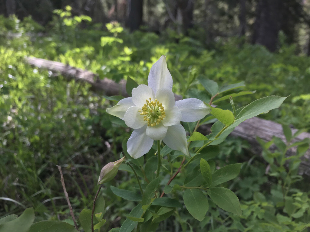
Portions of the old logging road contain serious deadfall to navigate through. The work is worth it, though. Kerr Creek and Gibbs Creek tumble down the mountain, through emerald-green, wide-open meadows and wonderful vistas of the surrounding countryside. Aspen, pine, spruce and millions of wildflowers line the path.
Arrowleaf balsamroot, Indian paintbrush and columbine were blooming during my visit. I even found the rare Pink Lady’s Slipper hidden in the deadfall. Of course, my cellphone camera failed to focus on what I believe is the only orchid capable of growing in the Rocky Mountains.
Deer, elk and moose left plenty of tracks and signs along the trail. The area is busier during hunting season when the many aspen trees turn gold.
Bring your bear spray, plenty of water and don’t forget to tell someone where you are going!


